National Seminar On Geo-Informatics And Spatial Applications
National Seminar On Geo-Informatics And Spatial Applications is an event that took place between 10-Feb-2006 and 11-Feb-2006 in Hyderabad.
-
Venue
-
Date/Time
-
Type
-
Price
-
Tickets At
-
Add New Field:
Geography, the discipline, is no more the static science that maps rivers, capitals, nations and mountains. With technologies as accessible as Google Earth, the school texts don't mean the same thing anymore. Remote Sensing, GIS, GPS and Geoinformatics allow Geography to become a multidisciplinary stream that amalgamates a number of areas such as social-science, science and technology to offer a dynamic and adjustable model of the world around us.
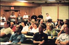
The National Seminar On Geo-Informatics And Spatial Applications will exclusively discuss the various technologies that have brought about this effect. Industry specialists, from organisations such as IIC Technologies, Erdas Imagine, Org GIS, NRSA, Survey Of India will be present, along with academicians from Bombay University, Pune University, NIRD etc.
The seminar will be inaugurated by the Director of NRSA Mr. K Radhakrishna. For further details, please contact S Simhadri at 2709-7192, 2768-2203, 94400-51409.
Be the first to comment on National Seminar On Geo-Informatics And Spatial Applications! Just use the simple form below.
LEAVE A COMMENT
fullhyd.com has 700,000+ monthly visits. Tell Hyderabad what you feel about National Seminar On Geo-Informatics And Spatial Applications!
MORE EVENTS IN THIS PERIOD
ALL EVENT CATEGORIES
SEARCH EVENTS
Dissatisfied with the results? Report a problem or error, or add a listing.
ADVERTISEMENT
SHOUTBOX!
{{ todo.summary }}... expand »
{{ todo.text }}
« collapse
First | Prev |
1 2 3
{{current_page-1}} {{current_page}} {{current_page+1}}
{{last_page-2}} {{last_page-1}} {{last_page}}
| Next | Last
{{todos[0].name}}
{{todos[0].text}}
ADVERTISEMENT
This page was tagged for
Department Of Geography Department Of Geography events
February 2006 events
hyderabad on campus / alumni
hyderabad speeches / talks